Waterfront Adaptation Plan
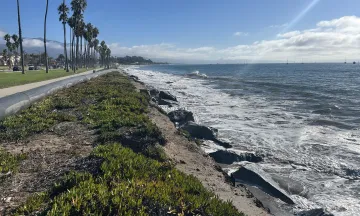
The City of Santa Barbara's Waterfront is a cherished community resource and cornerstone of the local economy. Today, it faces growing challenges from beach erosion and flooding during high tides and major wave events that are causing millions of dollars in damage, disrupting recreation and operations, and rapidly narrowing East Beach. Sea level rise will make these impacts more severe - view Sea Level Rise Interactive Hazard Maps to learn more about projected flooding and erosion from sea level rise.
The purpose of the Waterfront Adaptation Plan is to develop practical solutions to address coastal flooding and erosion for the next 30 years, while enhancing beach access, recreation, boating, and habitat.
Watch the following video to learn more about the Waterfront Adaptation Plan: What’s at risk, what's being planned for, and which early ideas are being considered to save the sandy beach, enhance recreation, protect the Harbor and inland areas, and make it safer to walk and bike.
Flooding and Erosion in Recent Years
-
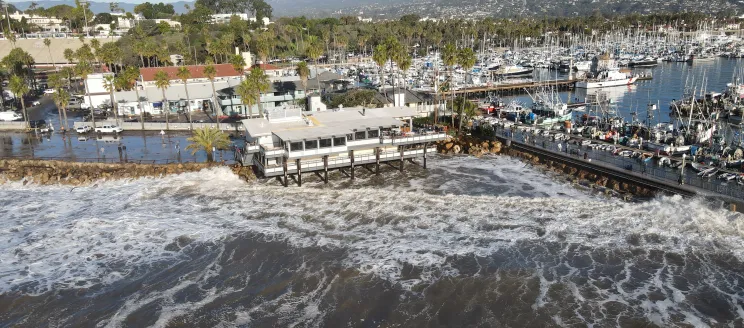
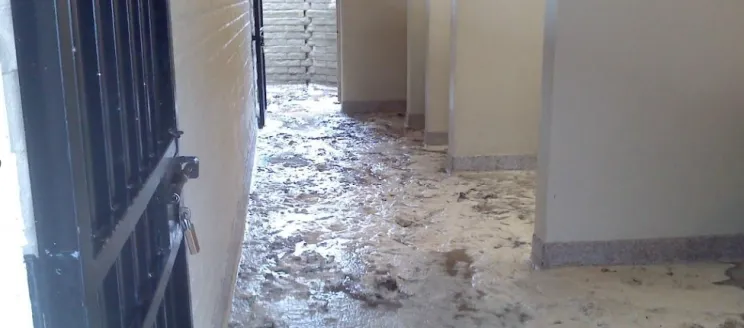
 Flooding in the Harbor Commercial Area
December 2023
-
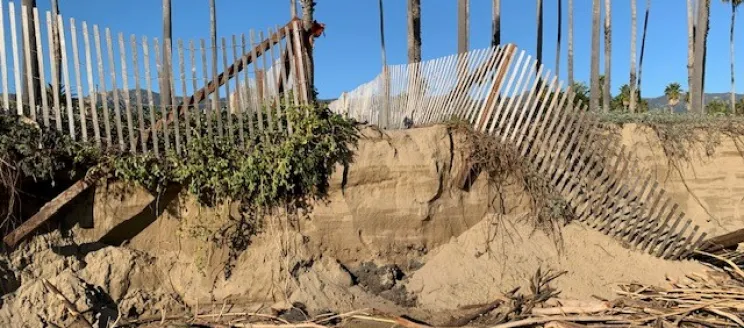
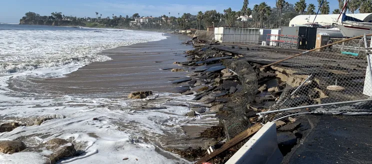 Beach erosion and partial collapse of the Harbor Boat Yard
January 2023
-
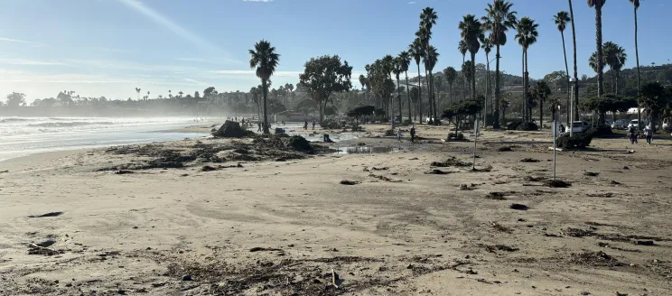
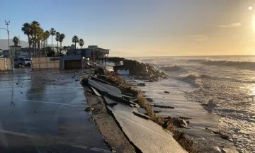
 Beach erosion and high tide at East Beach
November 2025
-
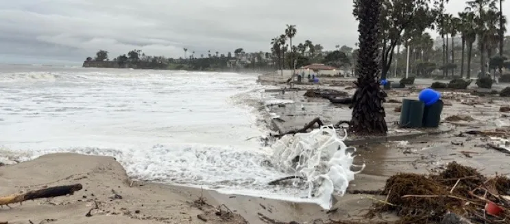
 Beach erosion at East Beach
December 2025
-
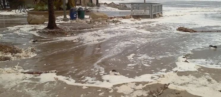
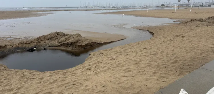 Stormwater flooding at West Beach
November 2025
-
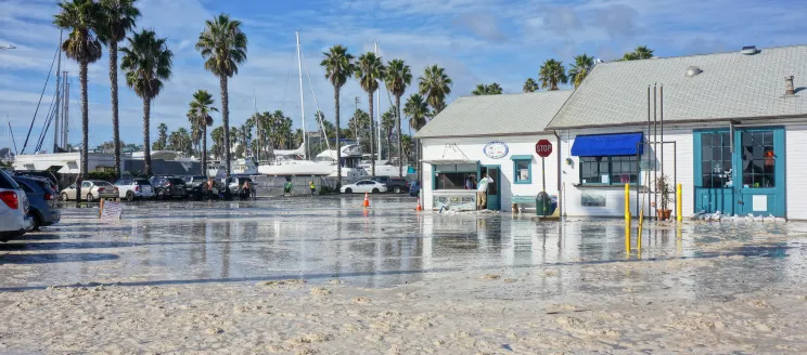
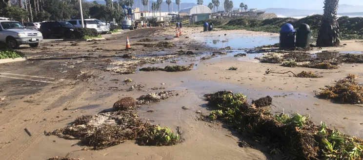
 Harbor West parking lot covered in sand and debris
December 2023
-
 Harbor West parking lot covered in sand and debris
February 2024
-
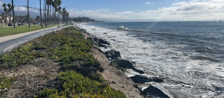
 Flooding and erosion at Leadbetter Beach
February 2024
-
 Large waves damaged and flooded the Harbor
January 2023
-
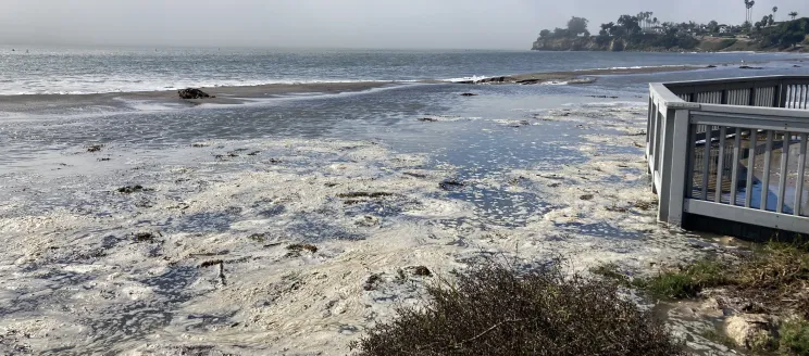
 Leadbetter Beach flooded during a high tide
December 2020
-
 Leadbetter Beach flooded during a high tide
October 2023
-
 Leadbetter Beach and parking lot flooded from large waves
March 2014
-
 Leadbetter Beach restrooms flooded from large waves
March 2014


What Can be Done to Protect the Waterfront?
The City is evaluating a range of adaptation options to determine which should be evaluated further for feasibility, effectiveness, timing, and cost. A draft Waterfront Adaptation Plan with a recommended adaptation strategy is anticipated for public release in early 2027.
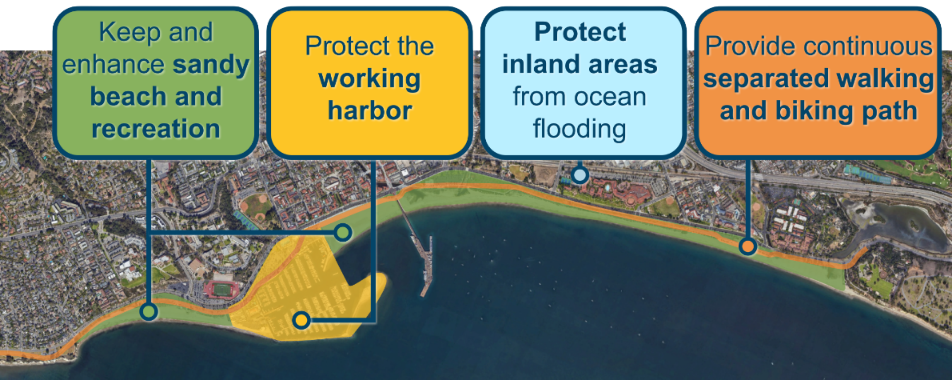
Waterfront-Wide Goals & Priorities
The City is prioritizing adaptation options that accomplish the following goals and priorities:
Initial ideas:
The following options are intended to reflect some initial ideas of adaptation measures and their phasing, which may change after the community engagement process and technical analysis.
The adaptation options could be implemented in phases based on actual changing conditions to ensure that projects happen at the right time and at the appropriate scale.
The City is currently envisioning the following three categories of projects:
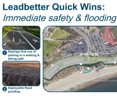
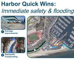
Quick Wins: Quick-to-implement, low-cost actions to address pressing safety and flooding issues now, such as temporary deployable flood barriers, drainage improvements, and restriping parking lots to provide a safe place to walk and bike.
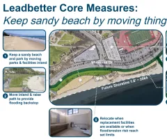
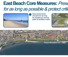
Core Measures: Large projects that comprehensively address flooding, erosion, and access issues for at least 30 years, including:
- Strategically relocating some features at Leadbetter and East Beach inland, including parking, restrooms, paths, park areas, to protect and preserve them and create space for wide sandy beaches.
- Adding sand, berms, and dunes to build up and maintain wide sandy beach areas.
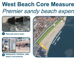
- Upgrading West Beach with better stormwater drainage to improve sand quality and adding amenities such as restrooms and showers to make it a premier beach destination.
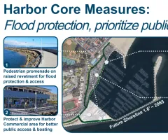
- Protecting the Harbor Commercial Area with a revetment topped with a pedestrian promenade to reduce flooding and erosion and improve public access between the Harbor and Leadbetter Beach.
- Improving the Harbor Commercial Area by expanding services for boating and commercial uses, increasing public access, and creating new revenue opportunities to help fund Waterfront improvements.
- Creating a safe, continuous, and separated walking and biking path along the entire Waterfront that is gradually elevated to protect the path and inland areas from flooding.
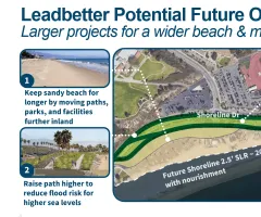
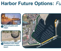
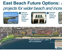
Future Options: Largest-scale, highest-cost projects that would address flooding and erosion at higher amounts of sea level rise, beyond 30 years, including:
- Raising the walking and biking path higher to provide more flood protection for inland areas.
- Moving paths, parks, and facilities further inland to create more space for wide sandy beaches.
- Adding groins, headlands, and offshore reefs to retain sand and widen beaches.
- Protecting the Harbor Marinas by raising the breakwater and installing wave screens.
For more details, view the Waterfront Adaptation Handout and Options or view the images below. These are initial ideas that will evolve through community input and further technical analysis.


How to get involved:
Timeline
Previous Meetings
Project Funding
Funding for this project is provided by the California Coastal Commission, California Coastal Conservancy, and City of Santa Barbara.