

Santa Barbara's Changing Climate: Flooding & Erosion
Santa Barbara is experiencing more frequent flooding, changing coastlines, and hotter days. These shifts are driven by a combination of global climate change and local environmental factors. From rising sea levels to more intense storms and heat waves, the science helps us understand what’s happening - and how we can respond. Scroll down to learn more.


Rising Sea Levels
Sea level rise refers to the gradual increase in the height of the ocean’s surface, driven primarily by climate change through melting ice and the warming of the ocean which causes it to expand. Scientists use different scenarios to plan for the future. For Santa Barbara, the Intermediate-High scenario, from the Ocean Protection Council’s 2024 Sea Level Rise Guidance, is the most likely range we plan for.
Scientists use different scenarios to plan for the future. For Santa Barbara, the Intermediate-High Scenario is the most likely range we plan for.
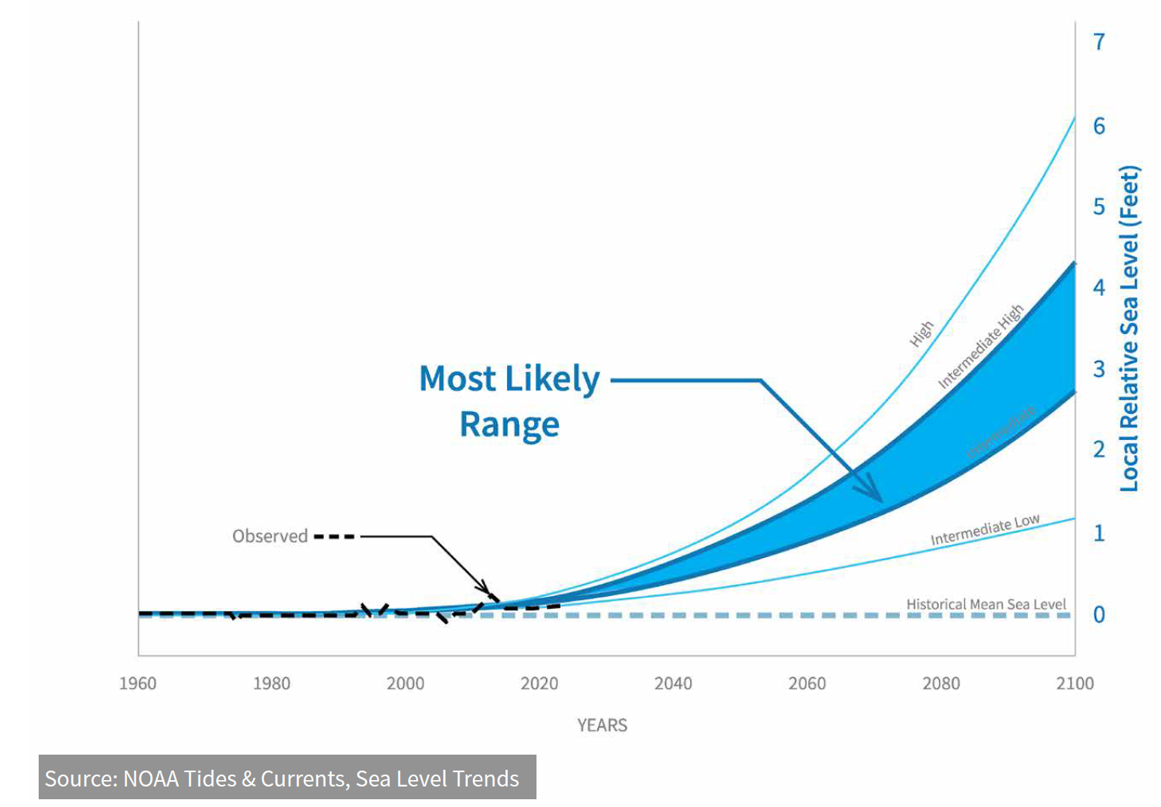
In Santa Barbara, this change is already visible along our coastline, and it’s expected to accelerate in the coming decades. High tides and storms are flooding low-lying areas, eroding beaches, and damaging parks, roads, and buildings near the waterfront.
Use the interactive inundation map below to see how different sea level rise scenarios and big wave events could affect our coastline. Zoom in to explore specific locations and understand what future conditions might look like.
Photo: Leadbetter Beach during a King Tide, November 2025.
