Skip to main content
Skip to main navigation
Search Site
English
Español
Create a Request
Sustainability navigation
Menu
Open Main Menu
Explore
Expand
Explore
Adaptation & Resilience
Expand
Adaptation & Resilience
Airport Climate Adaptation Plan
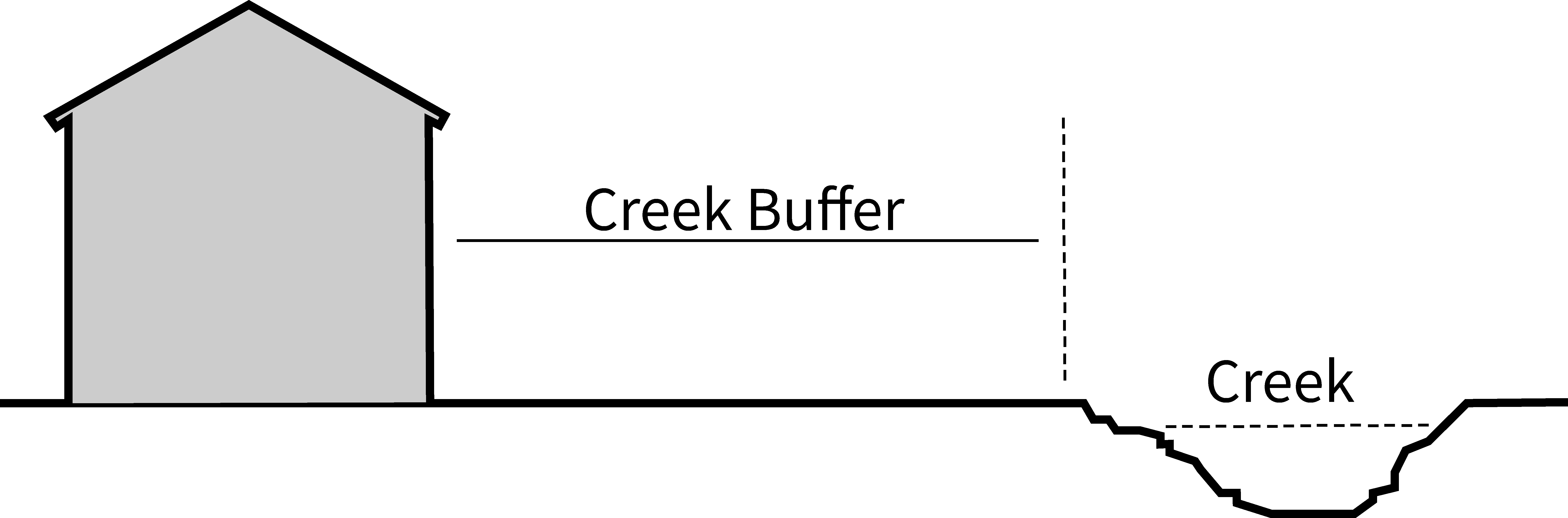
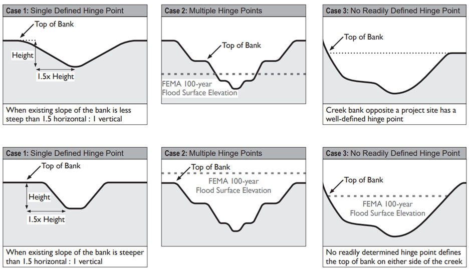
Creek Buffer Ordinance
Regional Coastal Adaptation Monitoring Program
Santa Barbara's Changing Climate: Flooding & Erosion
Sea Level Rise Adaptation & Vulnerability Assessment
Wastewater and Water Systems Climate Adaptation Plan
Clean Community
Expand
Clean Community
Deconstruction
Get Mulch
How to Dispose of Everything
Single-Use Materials
Trash Rates
Trash & Recycling Enclosure Design Guidelines
Elings Park Remediation
Community Engagement
Expand
Community Engagement
Code Enforcement
Creeks
Expand
Creeks
Education & Outreach
Creek Restoration
Storm Water Management Program
Water Quality Improvement
Energy & Climate
Expand
Energy & Climate
Active & Alternative Transportation
City Clean Energy Projects
Climate Action Plan
Santa Barbara Clean Energy
BCycle for All Expansion
Take Action
Expand
Take Action
Borrow from the Library of Things
Build Green
Electrify Your Ride
Get Involved
Go Solar
Report Pollution
Volunteer
Resources
Expand
Resources
For Residents
For Businesses
For Teachers & Schools
Development & Redevelopment
Programs & Projects
Utilities
Expand
Utilities
Santa Barbara Clean Energy
Expand
Santa Barbara Clean Energy
About SBCE
Programs & Offerings
Rates & Billing
Trash & Recycling
Expand
Trash & Recycling
Business Customers
Residential Customers
Understanding Your Trash Bill
Debris Boxes, Rolls Offs & Unscheduled Hauling
Drop-Off Locations
About Us
Expand
About Us
Contact Us
Equity
Frequently Asked Questions